LiDAR technology has transformed modern surveying, but even the most advanced sensors need dependable reference points to deliver highly accurate results. That’s where LiDAR Ground Control Targets come in. These specialized markers help align aerial and terrestrial scans with real-world coordinates, ensuring every point in a survey dataset is positioned with exceptional precision.
Below, we break down how these targets work, why they matter, and how they can elevate your entire mapping workflow.
Why Survey Precision Matters More Than Ever
In industries like construction, mining, and environmental monitoring, precise geospatial data is essential. Modern projects demand centimeter-level accuracy, often supported by LiDAR control markers that enhance the reliability of every survey:
- Monitor site changes
- Measure stockpiles
- Create detailed topographic models
- Plan utilities and design pathways
- Produce engineering-grade deliverables
Even small alignment errors can compound into costly miscalculations. This is why survey teams combine high-accuracy LiDAR with carefully placed control targets ensuring every scan aligns perfectly across multiple flights or field visits.
What LiDAR Ground Control Targets Actually Do
1. Anchor LiDAR Data to the Real World
These targets act as fixed, known reference points. When LiDAR scanners capture millions of data points, the control targets provide the positional truth needed for accurate georeferencing.
2. Reduce Positional Drift
Airborne and handheld LiDAR systems can drift slightly over long distances or in areas with limited GNSS reception. Targets help correct this drift during processing.
3. Improve Multi-Dataset Alignment
When combining scans from multiple days or different platforms (UAV, vehicle, tripod), control markers ensure all datasets line up seamlessly.
How These Targets Improve Accuracy
### High-Visibility Designs
Most targets use bold geometric patterns — checkerboards, circles, or reflective materials — that LiDAR systems recognize easily. This ensures consistent detection even under poor lighting or complex terrain.
### Compatibility With GNSS Surveying
Surveyors typically capture the exact coordinates of each target using RTK or PPK GNSS receivers. This gives LiDAR software precise anchor points to tie into the coordinate system.
### Enhanced Elevation Precision
LiDAR is known for exceptional elevation accuracy. Properly placed targets help refine vertical alignment, avoiding discrepancies in slope, height, or contour data.
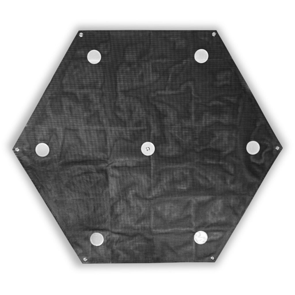
Types of LiDAR GCP Targets
- Checkerboard Panels — Great for photogrammetry + LiDAR hybrids
- Reflective Targets — Ideal for terrestrial scanners in low-light areas
- Portable Ground Markers — Lightweight and easy to deploy across outdoor sites
- Permanent Target Mounts — Used for long-term monitoring or repeated surveys
Using a mix of targets ensures strong detection across various environments and scanning angles.
Best Practices for Using LiDAR Control Targets
1. Spread Targets Evenly Across the Project Area
Avoid clustering. Place targets across the perimeter and within the interior of your site for balanced coverage.
2. Ensure Clear Line of Sight
Obstructions such as vegetation, machinery, or buildings can block the target from the scanner.
3. Capture Precise Coordinates
Use RTK GNSS or total stations to record each target location with centimeter-level precision.
4. Keep Targets Stable
Any movement before or during the scan can reduce accuracy. Anchor targets securely.
5. Use Enough Targets
Large and complex sites often need multiple control points to maintain spatial accuracy.
The Impact on Survey Results
By integrating LiDAR Ground Control Targets into your workflow, you can expect:
- Sharper digital terrain models
- Improved accuracy for 3D reconstruction
- Better alignment for multi-date scans
- Reliable measurements for engineering tasks
- Reduced processing corrections and rework
The difference in accuracy becomes especially noticeable on large, uneven, or obstacle-filled terrain.
Final Thoughts
LiDAR is one of the most powerful mapping tools available today, but even the best scanners need reliable reference points. LiDAR Ground Control Targets ensure that every dataset you collect is precise, repeatable, and perfectly aligned with real-world coordinates. Whether you’re mapping a construction site, monitoring a quarry, or analyzing environmental change, these targets enhance consistency and elevate the accuracy of your entire survey.